📍 Recent Trail Conditions
Log in to report🥾 Trail Info
🗺️ Trail Map
📈 Elevation Profile
🌤️ 3-Day Forecast
Forecast unavailable for this trail.
Upper Yosemite Falls: A Strenuous Climb to the Top of North America's Tallest Waterfall
Yosemite National Park, Tuolumne County
About Upper Yosemite Falls
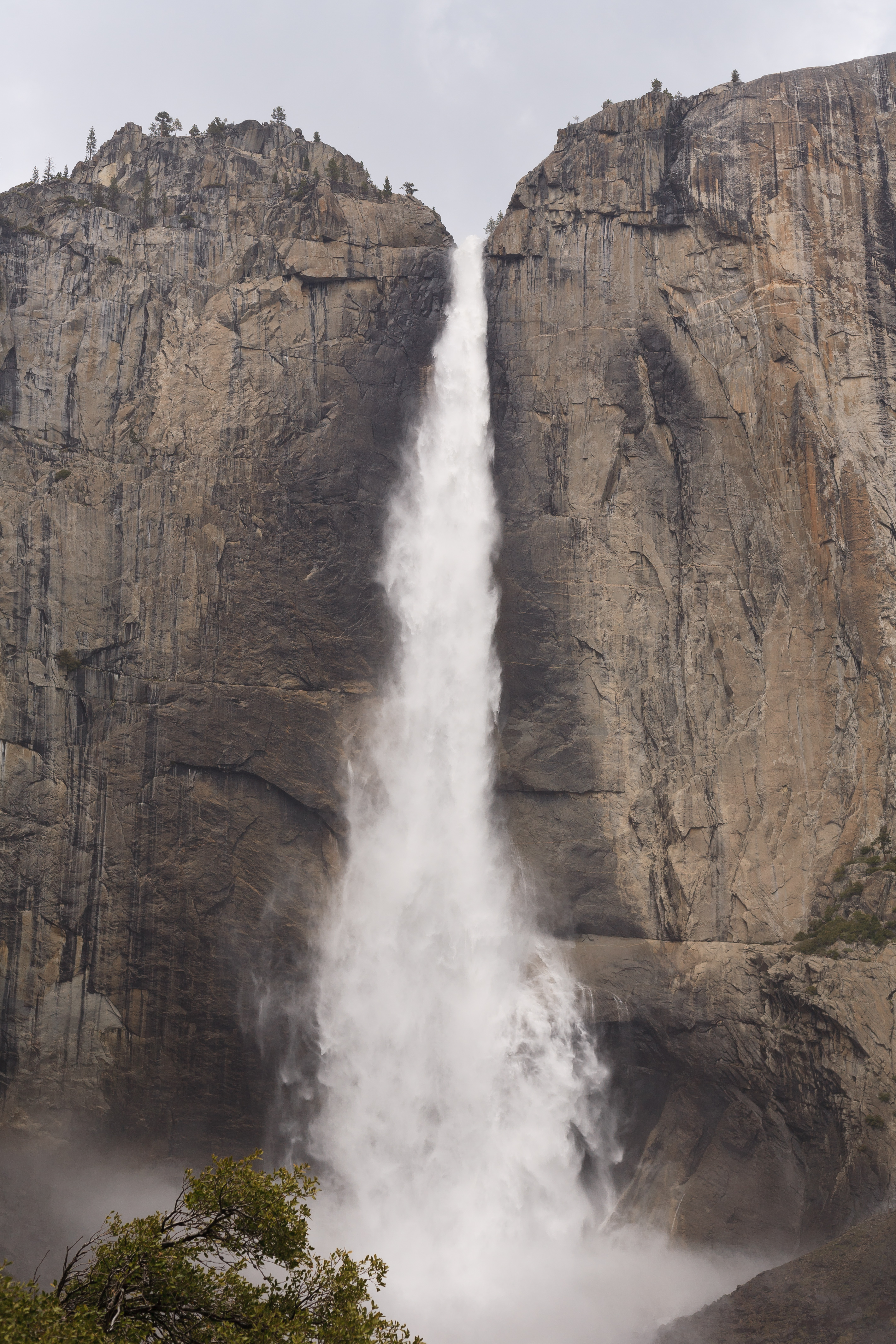
Yosemite Falls is the tallest waterfall in North America, plunging 1,430 feet in three separate tiers from the granite rim of Yosemite Valley to the valley floor below. The Upper Yosemite Falls Trail climbs 2,700 feet over 3.6 miles to the top of the falls — one of the most demanding and rewarding day hikes in all of California. The views from the rim are among the most spectacular in the entire national park system.
The trail switchbacks relentlessly up the canyon wall above Yosemite Village, offering increasingly dramatic views of Half Dome, Yosemite Valley, and the Sierra Nevada as you gain elevation. The final approach to the rim requires careful footing on polished granite. Standing at the edge above the 1,430-foot drop is an experience of profound exposure and beauty.
Trail Highlights
- 1,430-foot freefall — the tallest waterfall in North America
- Views of Half Dome, Yosemite Valley, and the High Sierra from the rim
- 2,700 feet of gain over 3.6 miles — one of Yosemite's most demanding hikes
- Peak flow in May and June from Sierra Nevada snowmelt
- Snow-covered trail above 6,000 feet can persist into June — check conditions
Trail Description
From the Upper Yosemite Falls Trailhead near Camp 4, the path begins with immediate and relentless switchbacks up the canyon wall. The Columbia Rock overlook at 1 mile provides a compelling reason to pause — the view of Yosemite Valley and Half Dome from here is already exceptional.
Above Columbia Rock the trail continues its sustained climb, eventually wrapping around the canyon and approaching the top of the falls from above. The final section involves careful travel on polished granite slabs near the rim. The view down the 1,430-foot drop and across the valley is astonishing. Return via the same trail — knees will feel the descent.
Tips & What to Bring
- Carry 3 liters of water minimum — this is a long, sunny, exposed climb
- Start before 7am to finish before afternoon thunderstorms and heat
- Trekking poles are strongly recommended for the steep, knee-punishing descent
- Snow may cover the upper trail well into June — carry microspikes in shoulder season
- The lower falls view from the valley floor is stunning and requires zero effort — worth doing first
Getting There
From Yosemite Valley, take Northside Drive to the Camp 4 parking area (or ride the valley shuttle to Stop 7). The Upper Yosemite Falls trailhead is adjacent to Camp 4. GPS: 37.7492, -119.5975.
📥 Download GPX File
Load the GPX track for Upper Yosemite Falls onto your GPS device or phone app before you head out.
Download GPX